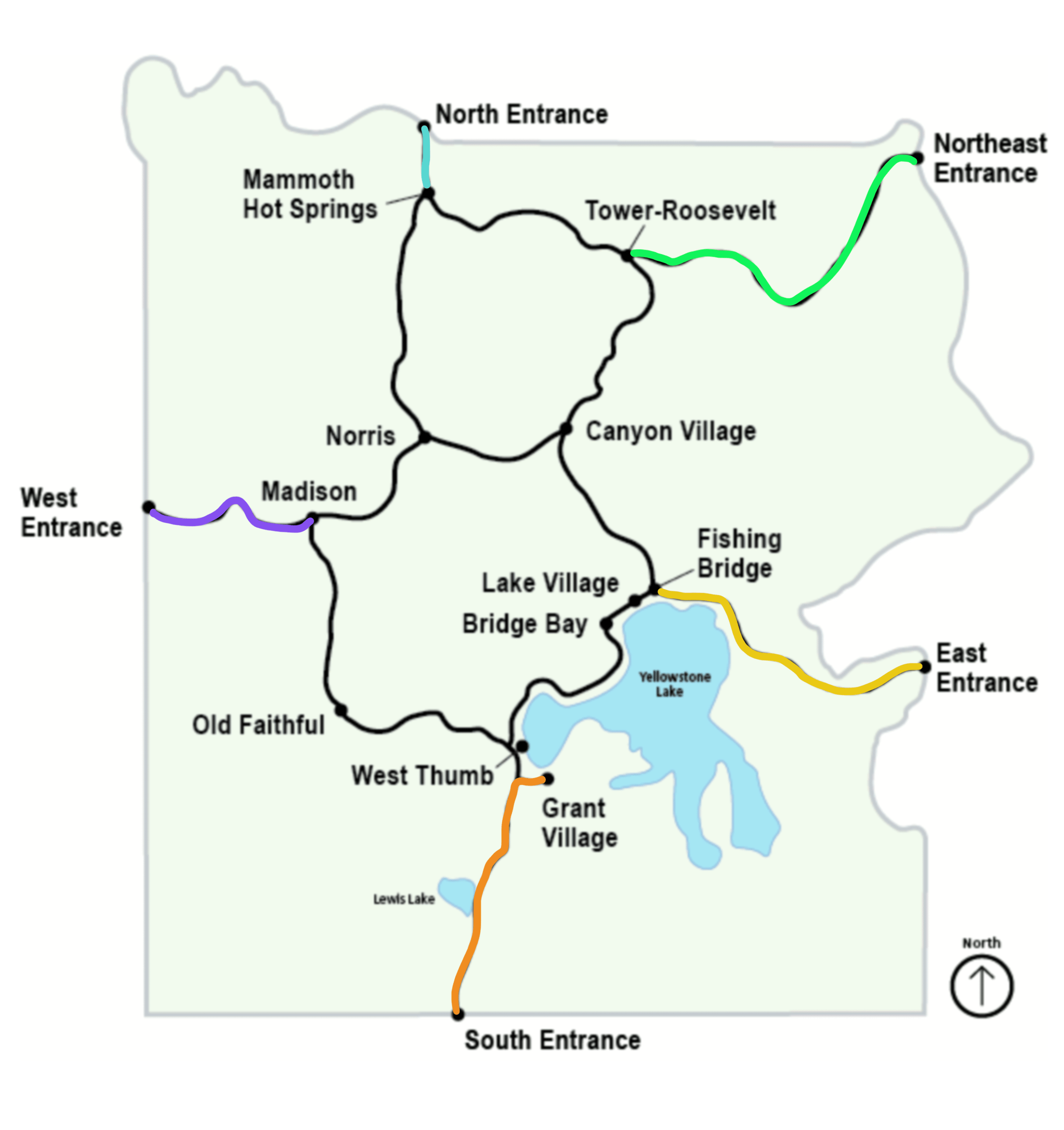
Once you drive through one of Yellowstone’s five gates, don’t rush to drive to the Grand Loop. Take your time to explore each entrance’s road segment landmarks, pull-outs, and sites. Below we’ll explore each road leading from the gate into the figure eight Grand Loop. Each entrance road segment’s highlights are listed chronologically and bulleted so you can print this article and highlight which ones your family will want to do. The below-bolded items are stops we made during our visit and thoroughly enjoyed.
South Entrance Road
South Entrance to Grant Village
Jackson, Wyoming is 57 miles south of the South Entrance. You’ll drive by Grand Teton National Park on your way north. We recommend adding a day or two to your itinerary to cover Grand Teton.
- From the South Entrance, be sure to stop at Moose Falls.
- Pitchstone Trailhead leads to a strenuous 16.3-mile hike on-way to the Pitchstone Plateau.
- Enjoy views of the Lewis River as it runs along the road and Lewis Lake.
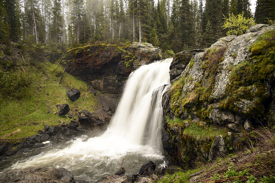
- Stop at Lewis Falls
- Heart Lake Trailhead leads to a 17.4-mile one-way hike past thermal areas to Heart Lake
- Shoshone Lake/Dogshead Trailhead – 10.8-mile there-and-back hike
- Riddle Lake Trailhead- 5-mile round trip hike to Riddle Lake with views of Mount Sheridan and the Red Mountains to the south.
- Arrive at Grant Village.
West Entrance Road
West Entrance to Madison
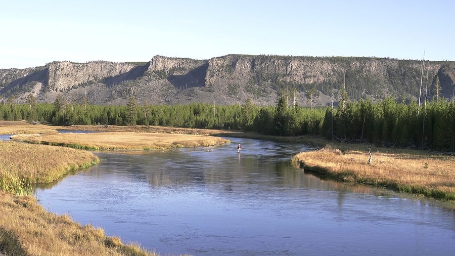
The town of West Yellowstone, Montana is located right at the West Entrance, from the gate to the Grand Loop at Madison is 14 miles. The road hugs the route of the Madison River.
- Your first stop could be less than half a mile into the park at Barns Hole Road where you can walk down to the river.
- Stop at Two Ribbons Trail for an easy .75-mile boardwalk loop.
- Riverside Drive is a one-mile, one-way drive along the Madison River’s edge.
- Gneiss Creek Trailhead leads to two 9+ mile hikes.
- Pull over to view the eroded rock of Talus Mountain.
- Stop at the Mount Haynes Overlook for a good view of the 8,235-foot peak.
- Enjoy an easy 1-mile round-trip hike at Harlequin Lake Trailhead before you arrive at Madison.
North Entrance Road
North Entrance to Mammoth Hot Springs
Gardiner, Montana is the doorstep of the North Entrance starting at the Roosevelt Arch. This entrance remains open year-round. From the entrance to the Grand Loop at Mammoth Hot Springs is a short 5-mile drive.
- As you drive, be on the lookout for Eagles Nest Rock, high above the road, which has served as a nesting location for eagles.
- Stop at the pullout at the 45th parallel, take a pic at the sign to mark your time halfway between the equator and north pole.
- Take a break at the Boiling River Trailhead. Change into swimwear at the single restroom and head down to the Boiling River Hot Spring about a half-mile walk upstream along the Gardner River. Check online to see if the trail is open.
- Lava Creek Trailhead leads to an 8.4-mile round trip trail, a shorter destination is to hike 0.7 miles in to the footbridge crossing the Gardner River.
- A short drive from this point will lead you to Mammoth Hot Springs.

Northeast Entrance Road
Northeast Entrance to Tower-Roosevelt
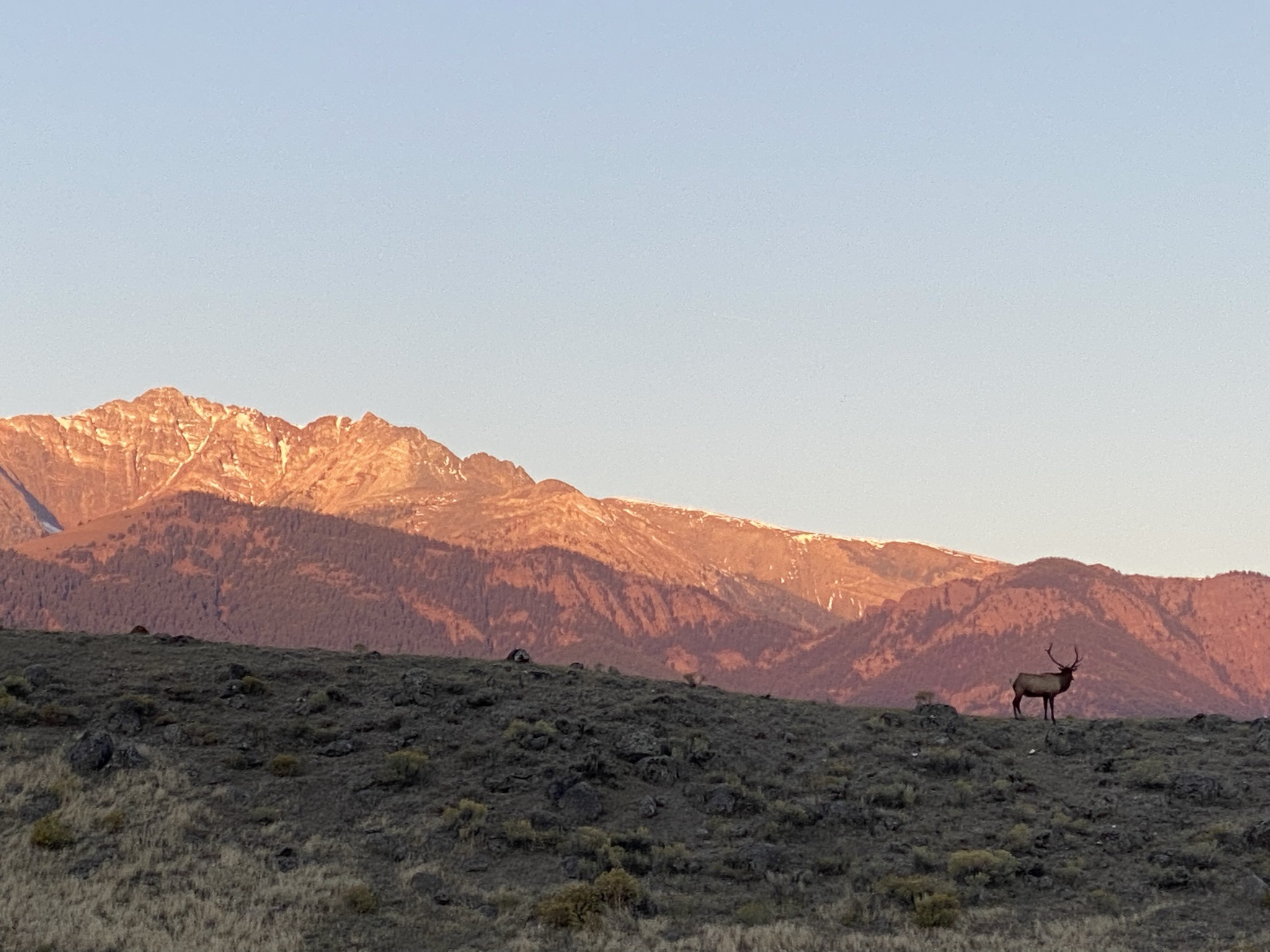
The Northeast Entrance at Silver Gate, Montana leads to a 29-mile drive through Lamar Valley to the Grand Loop at Tower-Roosevelt. Wildlife in the Lamar Valley is most active in the morning and at dusk. We recommend visiting this area in the morning as when it gets dark at Yellowstone, it gets very dark.
- The first trailhead is at Warm Creek. Pebble Creek Trail is a 12-mile strenuous one-way hike. Remember you don’t have to hike the whole trail.
- Stop at Barronette Peak Pull Off and use your binoculars to see if you can find any white mountain goats up on the cliffs.
- In the summer months, check the canyon walls and floor in Ice Box Canyon to see if there is still ice and snow present. The deep ravine gets very little sun exposure and ice and snow may still be unmelted.
- Thunderer Trailhead gives access to Thunderer Cutoff Trail, a strenuous 7.4 there-and-back hike.
- Trout Lake Trailhead leads to the popular Trout Lake Trail, a 1.2-mile lollipop loop trail.
- Take the pullout at Soda Butte to view the travertine formation.
- Stop at the Lamar River Trailhead parking lot to look for and watch the animals. This lot gives access to the 33-mile Lamar River Trail. This is a popular stop and the lot will be busy.
- The Petrified Forest Trailhead is a 3.6 out-and-back, strenuous hike to view petrified trees. There are other opportunities in the park to view closer petrified trees.
- Yellowstone River Picnic Area Trailhead
- Specimen Ridge showcases hot springs and unbeatable wildlife-watching opportunities over a fairly difficult 16.9 miles.
- Agate Creek stretches a difficult 12.8 miles and is seldom used, but takes those willing to do a remote section of the river for prime cutthroat trout fishing locales.
- Yellowstone River Picnic Area Trailhead presents a steep climb for 3.7 miles following the rim of the Yellowstone River, from where you can see the Overhanging Cliff area, the towers of Tower Fall, basalt columns, and the historic Bannock Ford
- Arrive at Tower-Roosevelt
East Entrance Road
East Entrance to Fishing Bridge
Cody, Wyoming is 53 miles east of the East Entrance of the park. Once you arrive at this gate, you’ll drive another 27 miles to get to the Grand Loop at Fishing Bridge.
- Avalanche Peak Trailhead leads to a strenuous 4.4-mile there-and-back trail with panoramic views of Grand Teton Mountain Range, Yellowstone Lake, and peaks of Absaroka Mountain wilderness area.
- Check out Crecelius Cascade at a roadside pullout about 7.5 miles into the park. Walk the short trail to get closer.
- Stop at the Sylvan Lake Picnic Area to get some great pics by the lake.
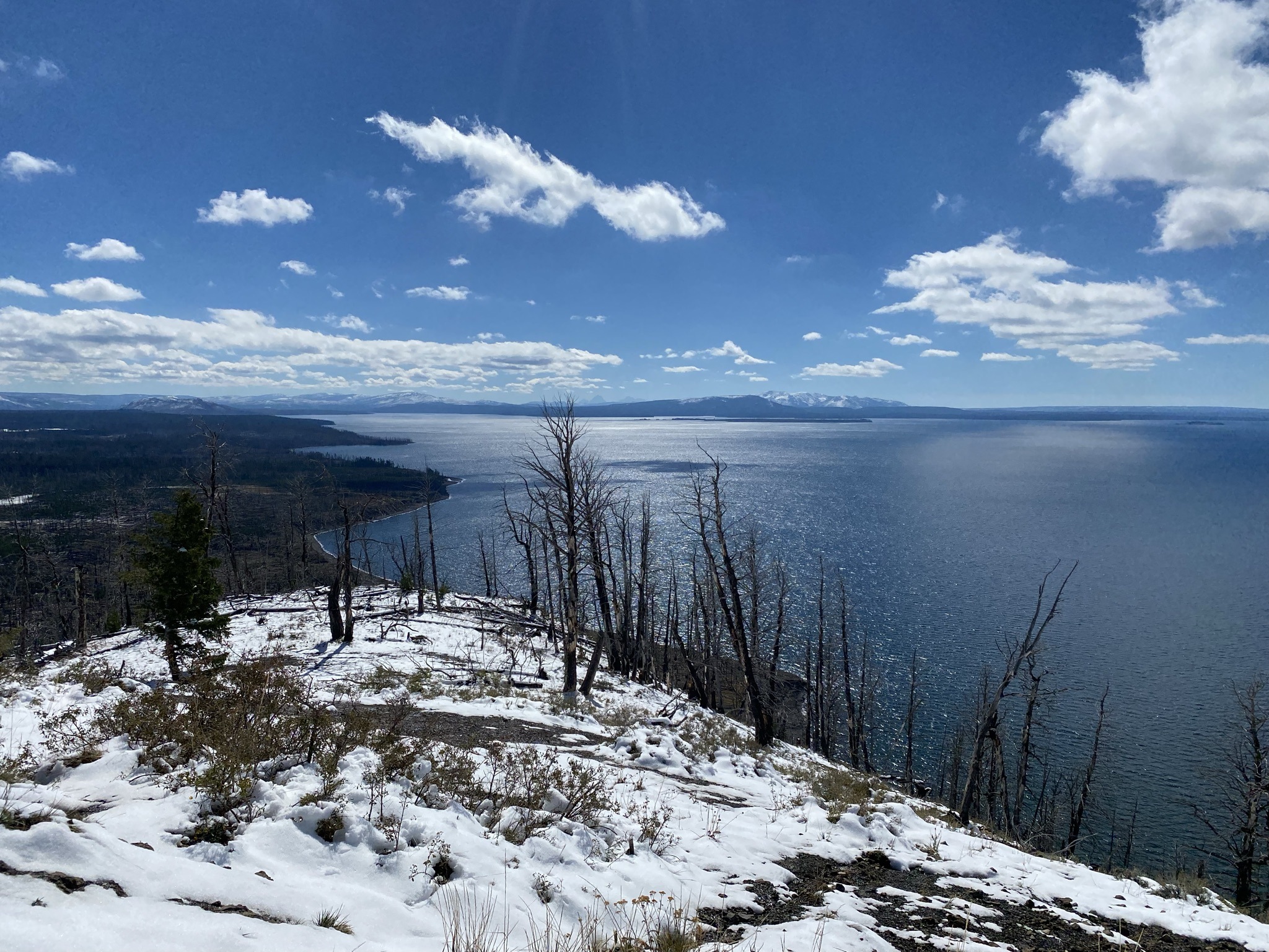
- A steep drive up the 1-mile paved road to Lake Butte Overlook will reward you with expansive views of Yellowstone Lake.
- Get down to the water at Sedge Bay Picnic Area pull-off although swimming is not recommended, the average temperatures of Yellowstone Lake are dangerously cold. Picnic tables and a restroom make this a great stop.
- Stop at the Steamboat Point overlook to enjoy the view of Yellowstone Lake and a few geothermal features.
- The Pelican Valley Trailhead starts a 6.2-mile there-and-back trail through meadows, forest, river valley, and a Bear Management Area.
- Storm Point Trailhead is the start of an easy 2.3-mile trek on a loop trail by Indian Pond.
- Take a short, easy 0.6-mile hike at the loop trail at Pelican Creek Nature Trailhead.
- A short drive will lead to Fishing Bridge.
We suggest adding the above entrance road segment activities to your itinerary. Incorporate them into your schedule with the nearby corresponding Grand Loop segment. Even if you don’t use the Yellowstone gate at the end, we think the above-bolded activities are worth the drive towards the entrance and back to the Grand Loop.
More Yellowstone Trip Planning Information:
- Yellowstone Guide to SE Grand Loop – Grant Village to Bridge Bay to Lake Village to Fishing Bridge to Canyon Village
- Yellowstone Guide to SW Grand Loop – West Thumb to Old Faithful to Madison
- Yellowstone Guide to NW Grand Loop – Madison to Norris to Mammoth Hot Springs
- Yellowstone Guide to NE Grand Loop – Mammoth Springs to Tower-Roosevelt to Canyon Village
- Guide to Yellowstone’s 5 Entrance Roads – What to See and Where to Stop
- Guide to Yellowstone’s 5 Entrances
- Where to Stay and Eat Inside Yellowstone with Kids
- Yellowstone National Park Guide with Kids – Itineraries, Maps, and 20 Tips for Visiting
- 12 Scenic Yellowstone Drives
- 12 Fabulous Yellowstone Waterfalls with Little to No Hiking
Pin to your Yellowstone board!